Harda District
Harda District |
About: |
|
Harda is a district located in the central part of Madhya Pradesh, India. It is predominantly an agrarian region, known for its fertile soil and agricultural output, particularly in crops like wheat, soybean, and paddy. The district is rich in cultural heritage and has a deep connection with traditional rural life. While it remains relatively undiscovered by mainstream tourism, its rustic charm, historical temples, and nearby natural beauty make it worth exploring.  |
Location info: |
| District Headquarters:Harda town |
| State: Madhya Pradesh |
| Coordinates: 22.34° N, 77.1° E |
Climate/Weather: |
| Summer: Hot and dry, with temperatures ranging from 30°C to 45°C (March to June). Monsoon: Moderate to heavy rainfall from July to September, helping agriculture in the region thrive. Winter: Pleasant and cool weather from October to February, with temperatures ranging between 10°C and 25°C. |
History: |
|
Harda has a significant historical background, having been part of the Narmada River Valley civilization. It was ruled by various dynasties, including the Mauryas, Guptas, and the Marathas. Harda became a district in 1998, carved out from the larger Hoshangabad district. It has a rich cultural history with influences from both Hindu and Muslim traditions, reflected in its festivals, local arts, and architecture. |
Interesting things to do: |
|
Rural Tourism: Riverfront Picnics: Visit Temples: |
Interesting things to Visit: |
|
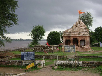
Narmada River: Mata Bhadrakali Temple: Trekking: |
Mobile range info: |
| Mobile network coverage may be weak within the fort due to its remote and elevated location. BSNL provides the most reliable network in the area, but signal strength may vary. |
How to reach? |
| By Air:The nearest airport is Devi Ahilya Bai Holkar Airport in Indore, about 270 km away. |
| By Train: The closest railway station is Mandsaur, around 85 km from the fort. Ujjain is another nearby station, about 165 km away. |
| By Road: The fort is well connected by road, and visitors can reach Hinglajgarh by bus or taxi from nearby towns like Mandsaur or |
Nearest Visiting places: |
| Gandhi Sagar Dam: A scenic dam located around 60 km from the fort, offering boat rides and stunning views. Hinglaj Devi Temple: Sculpture Museum: Trekking: |
Nearest Petrol Pump: |
| The nearest petrol pump is located in Bhanpura, about 20 km from Hinglajgarh Fort. |
Hotels/Lodge/Accommodation:
|
Things to carry: |
| Sturdy trekking shoes for exploring the fort and surrounding terrain. Light, breathable clothing for the hot weather. A hat, sunglasses, and sunscreen for sun protection. Water bottles and snacks, as there are limited amenities near the fort. A camera for capturing the historical architecture and scenic views. Insect repellent, especially if visiting during the monsoon season. |
Tips & Suggestions: |
| The best time to visit is during the winter months (October to February) when the weather is pleasant. The fort is located in a remote area, so it’s advisable to carry sufficient water, food, and other essentials. Respect the historical significance of the site by not disturbing the ruins or littering. Hiring a local guide can enhance your visit by providing insights into the fort’s history and significance. Be cautious while trekking, as some areas of the fort can be steep and uneven. |
Help Line/Phone Number: |
|
Police Station: 1.Police Station |
| Society/Community Phone Number9867546787 |
.jpg)
.jpg)
.jpg)
.jpg)