This Tourist Map Guide of Neemuch is written as a single, all-in-one reference for first-time visitors, pilgrims, business travelers, students, and families.
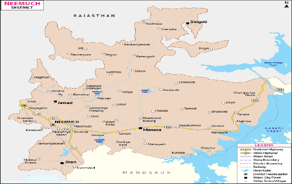
1. Where Neemuch Is Located (Map Orientation)
Neemuch is a north-western district headquarters of Madhya Pradesh, close to Rajasthan.
On a city map, you’ll notice:
- North: Border towns leading toward Rajasthan
- South: Manasa Road and agricultural belt
- East: Neemuch Mandi area and residential zones
- West: CRPF campus and cantonment areas
Neemuch is a planned, compact city, so most locations are reachable within 15–25 minutes.
2. City Zones Explained (Tourist Map View)
Central Neemuch
- Neemuch Ghanta Ghar
- Main Market (Sarafa, Cloth Market)
- Bus Stand Area
- Hotels, banks, restaurants
Cantonment & Institutional Zone
- CRPF Group Centre
- Military areas
- Wide roads, greenery
- Restricted zones clearly marked on maps
Residential & Local Areas
- Tagore Marg
- Baghana Road
- Scheme No. areas
- Schools, hospitals, parks
Outskirts & Day-Trip Routes
- Manasa Road
- Routes toward Gandhi Sagar
- Farm belts and small temples
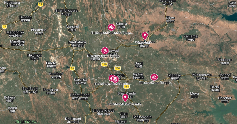
3. Major Tourist & Visitor Places (Map-Marked)
Neemuch Fort
Located near the old cantonment, Neemuch Fort reflects British-era military architecture. It’s a landmark often highlighted on tourist maps for orientation.
CRPF Group Centre Neemuch
One of the largest CRPF training centers in India. While entry is restricted, it is a major geographic reference point on all city maps.
Gandhi Sagar Dam (Day Trip)
Gandhi Sagar Dam
Located around 90 km from Neemuch, clearly marked on regional tourist maps. Ideal for a full-day visit.
Local Temples & Religious Spots
- Jain temples inside the city
- Hanuman temples near residential areas
- Small roadside shrines shown on local maps
4. Transport & Connectivity (Map Details)
By Road
Neemuch is well connected via state highways. Tourist maps clearly mark:
- Neemuch–Manasa Road
- Neemuch–Mandsaur Road
- Neemuch–Chittorgarh Route
By Rail
Neemuch Railway Station lies close to the city center.
Map symbols show:
- Auto stand
- Taxi pick-up
- Nearby hotels
By Bus
Main Bus Stand is centrally located and easy to spot on tourist maps, with routes to:
- Indore
- Udaipur
- Kota
- Mandsaur
5. Local Transport (How to Move Inside the City)
- Auto-rickshaws are the most common
- Shared autos on fixed routes
- Walking is practical in central areas
- Private taxis available for outstation trips
Tourist maps usually mark:
- Auto stands
- Bus stops
- Parking zones
6. Food, Markets & Daily Needs (Map Friendly)
Markets
- Main Bazaar (clothes, jewelry)
- Neemuch Mandi (spices and grains)
- Local vegetable markets in each area
Food Areas
- Central Neemuch for restaurants
- Street food near Ghanta Ghar
- Family dining near bus stand
All these clusters are usually shaded or icon-marked on visitor maps.
7. Hospitals, Safety & Emergency Points
Tourist maps highlight:
- District Hospital
- Private nursing homes
- Police stations
- Fire station
- Emergency roads
Neemuch is considered safe and calm, especially for families and solo travelers.
8. Best Time to Visit (Seasonal Map Notes)
- October to March: Best weather for walking and sightseeing
- April to June: Hot; indoor planning recommended
- July to September: Green surroundings, occasional road diversions marked on maps
Final Note for Visitors
Neemuch is simple, peaceful, and easy to explore. With a clear tourist map and this guide, even a first-time visitor can move confidently without confusion or stress.